About
Thornton is a small triangularly outlined township nestled in the Pemigewasset River Valley of New Hampshire's White Mountains midway between Plymouth and Franconia Notch.
County: Grafton
Altitude: From 555 to 2,610
Area: 32,640 acres
Population: 2,754 (2021 Census estimate)
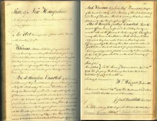
The township was granted to Matthew Thornton and others, in seventy-three shares on July 6, 1763, to contain 23,000 acres. It was named in honor of Mr. Thornton, who later became a member of the Continental Congress and a signer of the Declaration of Independence. No settlements were attempted under this grant and a new charter was issued October 21, 1768, including additional territory enough to make 40,071 acres in the whole, which was to be divided into ninety shares. The grantees were mostly men of Londonderry and vicinity, and the town was not incorporated until November 20, 1781. By 1880 Thornton had a population of 774. In 1885 the town had ten school-districts and ten common schools. There were 184 children attending school.
(From the Gazetteer of Grafton County, NH)
For information on things to do and places to see in the area please visit the Central NH Chamber of Commerce website
Town of Thornton Legislators for NH Congress
(For more information go to the State of NH website)
Representatives for Thornton
District 4
Heather P Baldwin: 363 Thornton Gore Road Thornton, NH 03285
State Senator for Thornton
District 02
Senator Lang; State House, Room 107, 107 North Main Street, Concord, NH 03301
Executive Councilor
District 2
The Honorable Cinde Warmington; PO Box 2133, Concord, NH 03301
Email Address: Cinde.Warmington@nh.gov
Office Phone: (603) 271-3632
Alternate Phone: (603) 387-0481
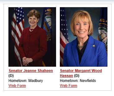
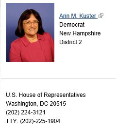
Town of Thornton Legislators for US Congress